
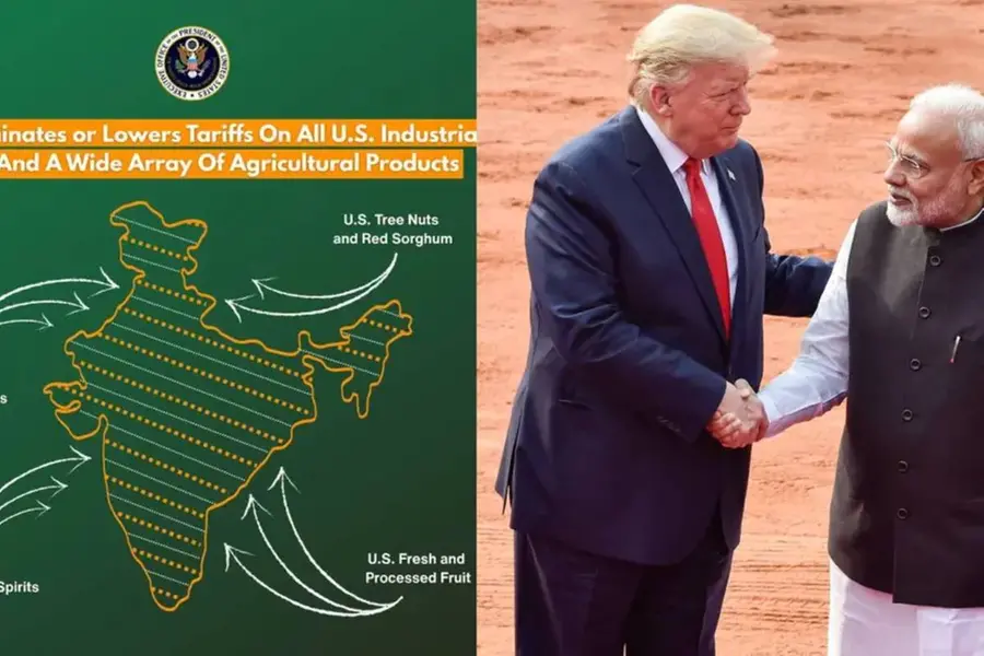
ന്യൂഡൽഹി: പാക് അധീന കശ്മീരും അക്സായി ചിനും ഉൾപ്പെടുത്തിയുള്ള ഇന്ത്യയുടെ ഔദ്യോഗിക ഭൂപടം ‘എക്സി’ൽ പങ്കുവെച്ച യു.എസ്., അതു പിൻവലിച്ചു. യു.എസ്. വ്യാപാരപ്രതിനിധിയുടെ ഓഫീസാണ് ഭൂപടം പിൻവലിച്ചത്. ഇന്ത്യയുമായുള്ള വ്യാപാരക്കരാറിന്റെ പ്രാഥമിക രൂപരേഖ പുറത്തുവിട്ട ശനിയാഴ്ചയാണ് ഔദ്യോഗിക ഭൂപടം യു.എസ്. ‘എക്സി’ൽ പോസ്റ്റുചെയ്തത്.
പാകിസ്താൻ സ്വന്തമെന്ന് അവകാശപ്പെടുന്ന പാക് അധീന കശ്മീരിനെയും ചൈന അവരുടേതെന്ന് അവകാശപ്പെടുന്ന അക്സായ് ചിനിനെയും തർക്കമേഖലകളായാണ് യു.എസ്. കരുതുന്നത്. അതിനാൽ, ഇന്ത്യയുടെ ഭൂപടത്തിൽ അവയെ കുത്തുകളാൽ വേർതിരിച്ചാണ് യു.എസ്. കാണിക്കാറ്. ആ പതിവുതെറ്റിച്ച്, കുത്തുകളാൽ ഈ സ്ഥലങ്ങൾ വേർതിരിക്കാതെയുള്ള ഭൂപടമായിരുന്നു ‘എക്സി’ൽ പങ്കുവെച്ചത്.
Content Highlights: US withdraws official map shared on X that included Pakistan-occupied Kashmir & Aksai Chin, raising questions about trade deal implications.
Published: 12 Feb 2026, 09:44 am IST
Related Topics
Disclaimer: Kindly avoid objectionable, derogatory, unlawful and lewd comments, while responding to reports. Such comments are punishable under cyber laws. Please keep away from personal attacks. The opinions expressed here are the personal opinions of readers and not that of Mathrubhumi.

Most Commented